
Imagine the following scenario: An earthquake in the Atlantic Ocean is detected, and within minutes, a prominent newscaster scanning Instagram sees a post warning that a tsunami is about to hit the northeastern seaboard.
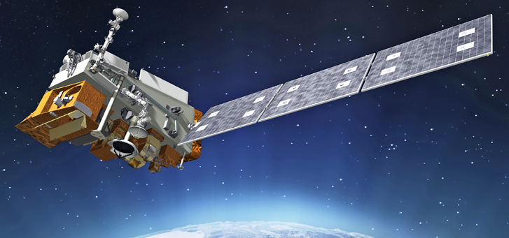
Artistic rendition of the Joint Polar-Orbiting Satellite System (JPSS-1). Image is courtesy of Ball Aerospace
At first, she dismisses it because it hasn’t been reported as credible elsewhere. Minutes later, however, social media erupts as ABCNews.com.co reports that the National Weather Agency has issued a tsunami warning for New York City and is urging immediate mass evacuations.
The stock market begins to tumble amid speculation that Wall Street will be flooded, and police are dispatched to deal with massive overcrowding on the subways. Within two hours, New York is crippled by fear, panic and confusion—despite the fact that there is no tsunami, and never was.
With the memory of 2012’s Hurricane Sandy fresh in the minds of many New Yorkers, it is not unreasonable to expect that people would be especially attuned to headlines of extreme weather reports, without necessarily paying attention to the details or the source generating the news.
Sandy was the deadliest and most destructive hurricane of the 2012 Atlantic hurricane season, and with damages estimated in excess of $75 billion, it was also the second-costliest hurricane in United States history.
The emergence of “fake news” sites, with fraudulent yet official-sounding entities like ABCNews.com.co or the National Weather Agency, has greatly increased the likelihood that legitimate weather events like an earthquake can be distorted through fake news sites—and then amplified through social media. And from a national security perspective, the probability that such efforts could be made with malicious intent is increasingly significant. Indeed, Forbes recently published a story on the imminent danger to the general public posed by fake weather forecasts that have gone viral through social media.
The Case for Stronger Environmental Intelligence
With so much potential for noise in the system, the need for credible Environmental Intelligence—and the instruments and platforms to gather the necessary data points—has never been stronger. The ability to routinely provide accurate Environmental Intelligence is critical to protecting lives and the nation’s infrastructure. As reported by NOAA, there have been more than 130 extreme weather events—including hurricanes, wildfires, floods or droughts, which have collectively caused more than $1 billion each in damage in the United States since the year 2000.
Simply defined, Environmental Intelligence is actionable information about the natural environment that has been analyzed and refined so it is useful to policy makers and the general public. Environmental Intelligence is used to help make decisions that protect lives, safeguard the country’s infrastructure, grow the economy, give the military a competitive advantage and even help people make day-to-day decisions.
The basic ingredients of Environmental Intelligence often include the following characteristics: relevant observations of the atmosphere, ocean and land surface; sophisticated systems to vet the observations and place them in a usable format; and powerful computing resources to run models and decision aids that produce useful products.
For more than 40 years, Ball Aerospace has designed and built innovative space systems that support actionable Environmental Intelligence. When Hurricane Sandy hit the United States’ east coast in November 2012, the Ball-built and NOAA-operated Suomi-NPP satellite provided critical measurements to help models predict that Sandy would take the infamous “left hook” into southern New Jersey. The National Weather Service model gave people on the ground more time to prepare, which likely saved lives and made a significant difference in how resources were deployed and evacuations planned.
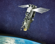
Artistic rendition of the WorldView-3 satellite. Image is courtesy of Ball Aerospace.
Observation satellites operated by NOAA and NASA, including operational platforms like the next-generation Joint Polar-Orbiting Satellite System (JPSS-1), Suomi-NPP’s successor, will play a significant and irreplaceable role in providing actionable Environmental Intelligence to decision-makers in government, business and the general public.
“With Sandy, the weather forecasters were able to get the prediction right,” said Scott Tennant, Ball Aerospace’s program manager for Suomi-NPP. “I think it saved some lives. It could have been much worse had they not dialed that path right in to determine where the hurricane would land. Suomi-NPP gives us more confidence about hurricanes’ paths and how to get people out of the way—safely.”
How Environmental Intelligence is Collected
Environmental Intelligence began in earnest with systematic observations of weather from fixed points on land and on water, but it wasn’t until the age of satellites that meteorologists and scientists began seeing entire weather systems and ocean features from the vantage of space. Space-based observations have the advantage of being able to make critical observations over the entire globe, which is particularly important because the physical environment has no boundaries.
The breadth and depth of Environmental Intelligence touches almost every aspect of human and commercial activity:
• Measuring ozone in the stratosphere. There are a number of government platforms and instruments that support NASA Earth science to provide decision-makers with the information they need to better understand the changing landscape of our planet. For example, the Ball-built Solar Backscatter Utlraviolet instrument (SBUV/2) helped to discover the ozone hole above Antarctica in 1987, and Ball’s Ozone Mapping and Profiler Suite (OMPS)—currently aboard Suomi-NPP and which will also fly on JPSS—will continue to measure and monitor the protective blanket of stratospheric ozone that surrounds the Earth into the 2030s.
• Enabling more accurate weather forecasts. CALIPSO and CloudSat are part of a constellation of spacecraft called the “A-Train,” including Aqua, Aura and PARASOL, dedicated to studying how clouds and atmospheric aerosols—key elements of the water cycle—impact long-range and short-term forecasts. In addition, the Global precipitation Measurement-Microwave Imager (GMI), the new microwave instrument calibration standard currently operating on the joint NASA-Japanese Aerospace Exploration Agency Global Precipitation Measurement (GPM) satellite, is improving scientific understanding of precipitation and enabling operational forecasters to better predict tropical storm intensities and tracks.
• Producing seasonal drought forecasts for farmers and fire prevention plans. The precisely calibrated Operational Land Imager (OLI) continues Landsat’s unprecedented 45-year record of earth remote sensing, helping experts make routine drought assessments and fire prevention plans; monitor land changes; and better understand the Earth’s ecosystem.
• Enabling first responders in disasters. In the aftermath of natural disasters, Environmental Intelligence is also helping first responders and emergency teams to deploy faster and more efficiently to priority areas. For example, the high resolution Earth imagery captured by WorldView satellites, three of which were built by Ball for DigitalGlobe, is used for civil government mapping, land-use planning, disaster relief, exploration, defense and intelligence, visualization and simulation environments, and navigation technology such as Google Maps.
Space-Based Environmental Intelligence Systems
The cost-effective development and delivery of Environmental Intelligence products and policies requires creative partnerships between industry, the government and academia. For this reason, there is a need to improve the capabilities and capacities of collective Environmental Intelligence-gathering efforts. This will need to be done with a combination of existing and new contracting mechanisms, large and small space systems, and new and upgraded ground infrastructures. Ball has strong partnerships with NASA, NOAA and the USGS, and continues to design and develop space-based observing technologies and strategies to help meet their critical Environmental Intelligence needs.
By continuing to develop technology critical to filling these observation gaps, the quality of actionable Environmental Intelligence for decision makers and the public can be improved. For example, the World Meteorological Organization (WMO) has stated that the development of satellite-based wind profiling systems remains a priority for the future global observing system. In particular, studies have shown that hurricane and typhoon intensity and track forecasts would be improved with direct measurements of 3-D winds. Improved forecasts give more advanced notice of extreme weather events to local governments, first responders and the public, which can help save lives and property.
NASA has made investments over many years in space-based wind LIDAR technology, and this remains an imperative area for future investment.
Looking Forward
It is possible that the “fake news” phenomenon will quickly pass as more people become aware of its existence, and that the general publics’ faith in weather forecasting will remain high. Ensuring both the credibility and the fidelity of these forecasts must remain a priority.

It is perhaps easiest to think that Environmental Intelligence is really about having a complete picture of the physical properties in the world that affects our way of life. Extreme weather events happen, and will likely increase in frequency and in the amount of damage caused. Through additional investments in Environmental Intelligence capabilities and continued public-private collaborations, the capacity to provide credible, accurate and longer-term predictions will ensure that national interests are safeguarded and US citizens remain safe.
Cory Springer is the Director, Weather & Environment, Strategic Operations at Ball Aerospace.