
Polar regions are faced with emerging challenges — climate change is affecting the entire globe, but it is especially pronounced at the poles. With an integrated EU Space Program in place, Europe has the capacity to better understand the challenges the Arctic Circle is confronted with, shape new mitigating policies as well as develop the necessary tools to fight climate change.
With nearly half the country sitting north of the Arctic Circle, Norway has a front row seat to the unprecedented changes taking place in this polar region. Climate change is causing temperatures in the Arctic Circle to rise twice as fast as anywhere else on the planet. As the ice melts, the Arctic Ocean is opening and shipping companies are moving in. According to the Arctic Council, ship traffic in the area grew by 25% between 2013 and 2019. It was also in this context that EUSPA Executive Director, Rodrigo da Costa, delivered a keynote speech at the Oslo Position Conference 2022. His visit to the Norwegian capital was a great opportunity to confer with Jan Christian Vestre, Minister of Trade, Industry and Fisheries, on the huge potential of EU Space across 17 markets.
Global Navigation Satellite System (GNSS) and Earth Observation (EO) revenues are expected to reach 500 billion by 2031. In addition, Norway has been supporting European innovation with several H2020 funded projects such as Prepare Ships. Da Costa also met with Norwegian Space Agency leadership and members of the Norwegian Parliament’s Standing Committee on Business and Industry to give an overview of how the Arctic stands to benefit from the EU Space Program.
“Increased maritime traffic in this remote polar region, in combination with more unpredictable and extreme weather events, raises many new challenges,” said Rodrigo da Costa. “In the event of a ship running aground or a collision, search and rescue crews have to navigate rough seas, freezing temperatures and vast spaces in order to evacuate the vessel and provide emergency services.”
This is where Galileo comes into play.
Galileo Supports Search + Rescue Operations
Galileo, Europe’s GNSS, provides improved positioning and timing information to a range of users — including search and rescue (SAR) teams.
Galileo’s SAR service contributes to life-saving efforts by swiftly relaying radio beacon distress signals to the relevant SAR crews by means of dedicated payloads onboard Galileo satellites, supported by three ground stations strategically deployed across Europe. But what really sets the Galileo SAR service apart is its unique Return Link Service (RLS) — a feature that allows people in distress to receive an automatic acknowledgement that their signal has been picked up by emergency first responders.
The Galileo SAR service is fully integrated into the Cospas-Sarsat system, a non-profit, satellite-based, search and rescue distress alert detection and information distribution system. The SAR transponder on the Galileo satellites picks up signals emitted from distress beacons in the 406 to 406.1 MHz band. It then broadcasts this information to dedicated ground stations called MEOLUTS, which use the signals to generate an independent location of the beacon. This location is then relayed to first responders through dedicated Cospas- Sarsat Mission Control Centers.
In Case You Missed It: EUSPA Celebrates ‘406Day’
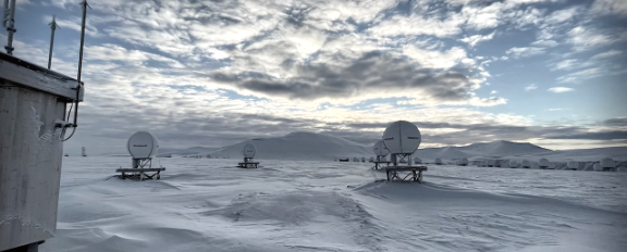
Because it offers greater coverage in higher latitudes and thus a more robust performance, Galileo brings particularly important added value to Arctic SAR operations — value which was on full display during a large-scale rescue exercise that took place in the Arctic Circle last year.
Following the activation of the onboard distress signal, the Galileo SAR service was able to track the ship’s location in just 2 minutes and 20 seconds and with an accuracy of under one kilometer.
Safe navigation, environmental protection and mitigating climate change
However, Galileo isn’t the only EU Space Program benefiting the Arctic. The Copernicus Earth Observation program’s Marine service provides ship captains and search and rescue teams with essential data on wave height and direction and the presence of sea ice, for example.
Ships of all sizes rely on the accurate positioning provided by Galileo to safely navigate across these remote waters.
Furthermore, as the Arctic sees more ship traffic, the risk of environmental catastrophes, such as oil spills, increases. Here, Copernicus satellites can provide optical and synthetic aperture radar images which, combined with accurate positioning from Galileo, allow authorities to quickly reach the spill site, understand the extent of the risk, and implement necessary actions. The EU Space Program also plays an important role in mitigating how climate change impacts the Nordic environment.
On the one hand, the accurate navigation offered by Galileo and EGNOS can optimize shipping routes to reduce greenhouse gas emissions and fuel consumption. On the other hand, the Copernicus Marine and Climate Change Services monitor a number of key climate indicators, such as sea level, temperature, currents and salinity. This data can then be used to drive global climate policy decisions.
All the benefits that the EU Space Program brings to the Arctic region are highlighted in a short film produced by EUSPA, which was premiered for the Norwegian Space Agency. “Protecting the Arctic and its many ecosystems are an important component of the EU Green Deal,” said da Costa while introducing the film. “Through an integrated EU Space Program and by working closely with our partners in the Arctic like NOSA, we are better-positioned to understand the challenges, find solutions and implement change.”
ec.europa.eu/defence-industry-space/eu-space-policy/eu-space-programme_en