
The European Organization for the Exploitation of Meteorological Satellites (EUMETSAT) is an intergovernmental organization created through an international convention agreed by a current total of 30 European Member States. EUMETSAT was founded in 1986 to supply weather and climate-related satellite data, images and products to the National Meteorological Services of its Member States in Europe, and other users worldwide. In this interview with Mr Vincent Gabaglio, the International Relations Officer of EUMETSAT, Space in Africa discusses ongoing partnerships between EUMETSAT and Africa, and the future of EUMETSAT in Africa.
Can you offer a highlight of EUMETSAT’s operations in Africa? Just a succinct highlight of what you have done in Africa so far.
Vincent Gabaglio (VG)
Our main focus in Africa is to ease access and use of our satellite data by African users. We respond to an African demand for our satellite data, channelled through the World Meteorological Organization (WMO) and through the Joint EU-Africa strategy via the African Union Commission, the RECs and the AMCOMET (African Ministerial Conference of Ministers in Charge of Meteorology).
Weather and climate are playing a very important role in various socio-economic sectors in Africa: agriculture, water management, transport, etc. There is therefore a strong demand for weather and climate information to ensure sustainable development in these various sectors. Our satellites observe Africa very well, especially the geostationary one (Meteosat series), which are located above the Guinean Gulf and the Eastern Coast of Africa. The data collected by the satellite complement the ground weather and climate observation that are unfortunately still too scarce in the continent. Our strategy is, therefore, to make our satellite data easily accessible and exploitable by African users, so that they can make their own forecast, and build their own products and services that can respond to the various needs in their countries or regions.
In order to achieve this, we deploy various activities and tools dedicated to Africa, in close cooperation with African institutions. We have a specific data dissemination mechanism, which is independent of the internet and can reach any users anywhere in Africa (EUMETCast). Our data are free of charge for national users. We cooperate with four training centers. We keep close links with our user community through expert group and fora to ensure a lively communication. We collaborate with all National meteorological services and many other national and regional institutions in the continent. More than 350 entities use our data daily in Africa and many other scientific users.
Finally, we also contribute to several capacity-building initiatives, such as the GMES&Africa program and other programs that aim at establishing Climate services in the continent (intra-ACP Climate services program) or increasing disaster resilience (SAWIDRA). These CB programs are funded by the European Union, in cooperation with the African Union, African Development Bank, and implemented by African entities.
EUMETSAT recently worked on a project to reduce the effect of the locust outbreak in East Africa. Can you briefly talk about this?
VG
This is something that the IGAD Climate Prediction Center for Eastern Africa (ICAPC) is doing. They actually gather all data and create these locust monitoring services. The point is that in order to predict, observe and monitor the evolution of the locust, they are also using weather and environmental parameters like wind, rain, humidity, vegetation and our satellites, as well as those we operated for the EU Copernicus program, support the observation of these parameters. We recently wrote an article about this, which is accessible via this direct link...
You have this ongoing partnership with GMES&Africa. Can you expatiate on what the partnership brings for Africa in terms of meteorological data for climate and weather?
VG
We indeed cooperate closely with the African Union Commission, who is in charge of implementing the GMES&Africa Program, which is part of the Joint EU-Africa strategy and aims at delivering services to decision-makers based on the monitoring of natural resource on land and at sea, mainly using Earth observation from the EU Copernicus program but also from EUMETSAT satellite. Most of the services developed by African consortia in GMES&Africa needs weather and climate information, and our satellite data contribute to this.
EUMETSAT also operates satellites of the Copernicus program on behalf of the European Union and deliver data, and training related to these satellite data.
VG
What is key for us, with a program such as GMES&Africa, is that it brings a solid institutional layer, on top of the technical and scientific one. GMES&Africa is more than a project. It is a framework that links Earth Observation (EO) specialists, scientists, professionals in various socio-economic sectors (fisheries, agriculture, water management) and policymakers. This is a unique network that can ensure that data coming from a satellite can have an impact on people’s life. In doing so, all technical, scientific and capacity building activities that are performed in Africa, based on EO, can be done in a framework that maximizes impact and sustainability.
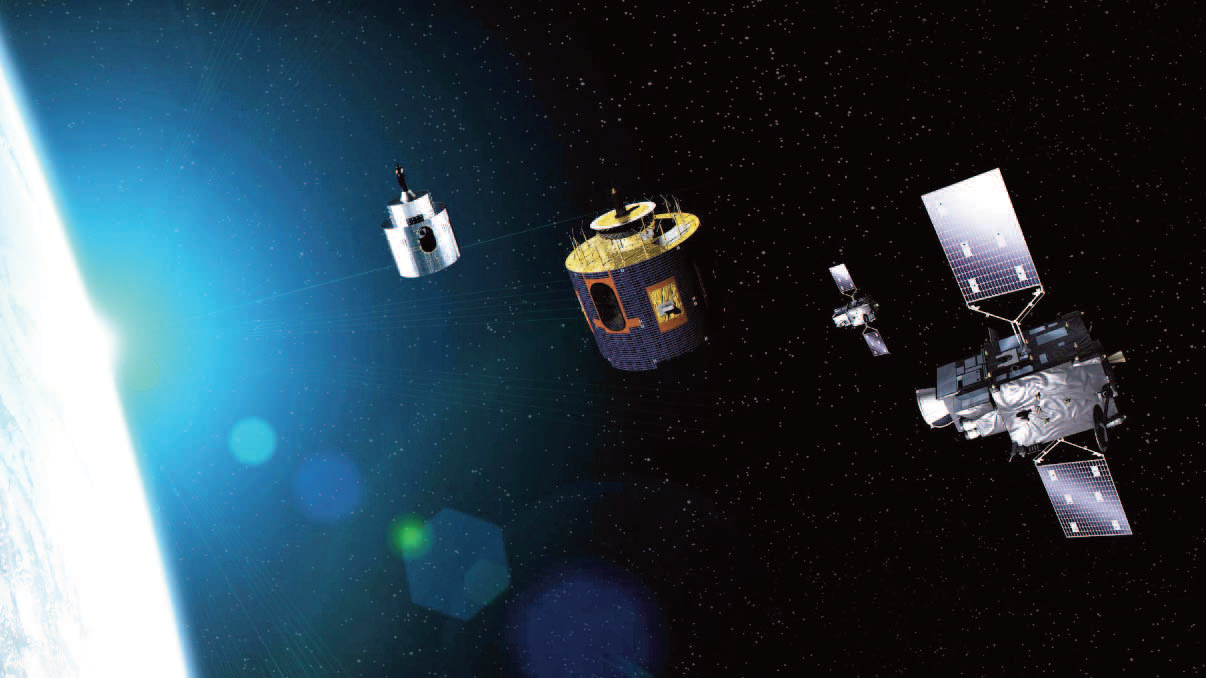
Artistic rendition of EUMETSAT’s Meteosat satellite series.
Do you think, over time, since you’ve been working in the African space industry, that analysis of satellite data towards taking proactive steps and policy formulation has improved or do you think African countries are much more preventive than they are reactive?
VG
I think they’ve largely improved, although there’s still some room for further progress, as always and everywhere. That’s why when we speak about capacity building, it’s not only infrastructure and human skills, it also has a lot to do with institutional capacities. Being able to deliver the right information to the right person at the right time, this needs to not only have good technicians but to also have a good institutional framework in Africa so that, for example, in case of disasters when there are cyclones, the flow of information, early warning, alerts and alarm can be channelled appropriately, Looking how the cyclone evolve in our satellite data is the “easy part” of the equation, it is the establishment of the whole value-chain that is a challenge.

Sometimes, I’d say, in the projects in which we are involved in Africa the technology aspects represent less than ten percent of the effort. The main part is capacity building; including the institutional one in order to make sure that the information provided via satellite and the services generated have a real impact.
African institutions are interpreting the data, creating services and those services need to be delivered to the correct persons and it is building this value chain which is the biggest challenge. Having satellites and getting access to the data requires some work and effort, but the real challenge is building the service chain and that policymakers or whoever is the recipient of this information trust the service which is delivered based on EO.
Our main partners in Africa are not the space industry, we are working more directly with the institutions active in agriculture, in water management, in fisheries. In these areas, we have seen a lot of progress over the past years. the locust monitoring in Eastern Africa is a good recent example, they were able to deliver the information quite easily to decision-makers. So, these types of services have progressed a lot over the past years.
What I’d like to say is that despite all this progress, there are more and more satellites, more and more data available and more and more services that can be provided to various socio-economic sectors, whose operations are dependent upon weather, climate and environmental conditions. At the same time that capacities in Africa to create services based on satellite data is increasing, the potential for more services is also increasing a lot. I’d say, the gap between what is done and what could be done still remains important but progress has been made for sure.
One of the contributions that EUMETSAT has been able to make towards reducing the gap between the potential and what can be done is through the regional climate centers. Can you talk about the regional climate centers?
Flag of the African Union
VG
Indeed we work closely with them, and they can speak much better than me about how they use satellite data! We recently organized a webinar with the Africa Development Bank where Regional Climate Centers demonstrated the products and services that they are providing in the region based on those EO. For us, they are quite important institutions as they are being set up by the countries in their region, and all countries can benefit from their capacities, know-how, and expertise.
Those institutions have a strong institutional mandate in their regions. They are present and they serve the countries in their regions. We are also working a lot with the countries but what we find out is that sometimes, in order to reach the necessary capacities, you need to have a critical mass and you cannot necessarily reach this critical mass in each and every country. The regional layer, well connected to countries, is, therefore, a very important link.
If there are sufficient capacities at regional levels then the regional centers could efficiently support national institutions to perform their mandate. For us, working with regional centers is important. They have the expertise and they are very much closer to the individual countries than we are, They know better than us what is needed either is regional or national level. This does not mean that we are not working with the countries. Each and every country in Africa has reception stations to get direct access to our satellite data and generate services. We have very active users in each and every country in Africa.
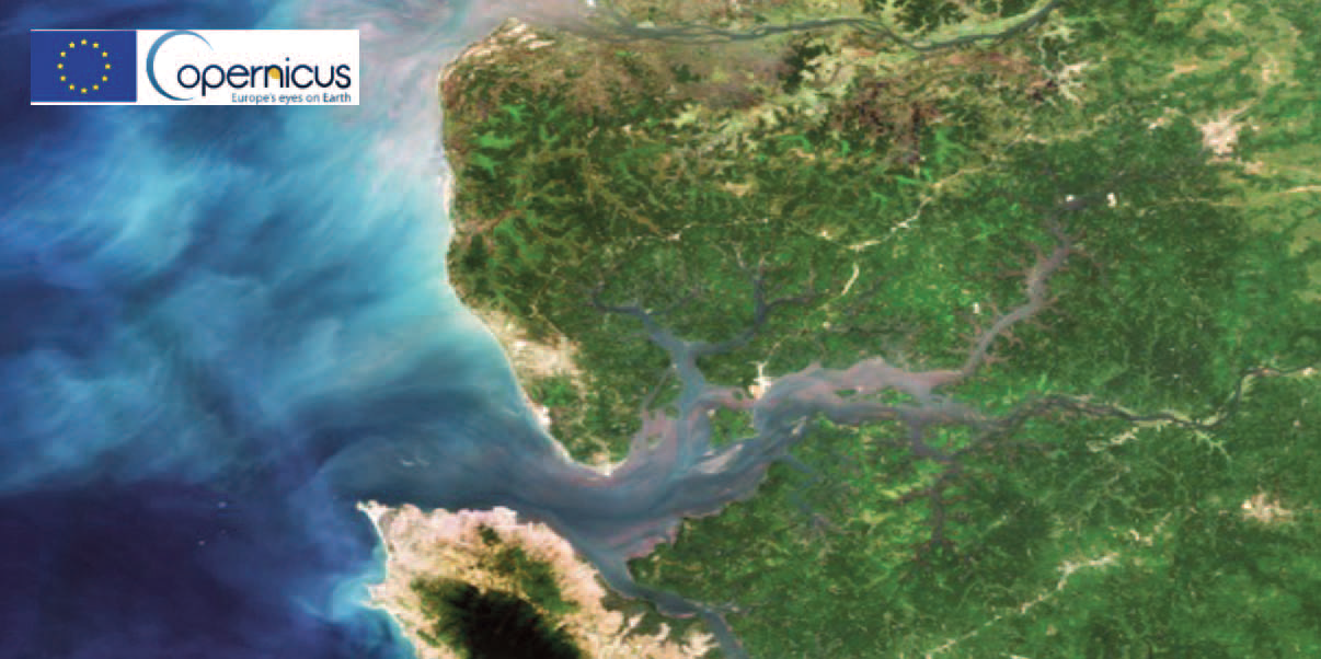
This Sentinel2A Satellite image of Sierra Leone in West
Africa captured by the Sentinel2A satellite.
For some services, such as extreme weather alert, it’s important to deliver our data directly at the national level. And expertise needs to exist at the national level also to deal with the data. The difficulty is sometimes in keeping or retaining this expertise. And thus, once again, the need to reach a critical mass of capacities at the regional level for the benefit of all countries in that region.
Are any projects EUMETSAT is currently working on or that are in development that you’d like to discuss with African readers.
VG
For us, what is very key for the years to come is the transition to the next generation of meteorological satellites: the Meteosat Third Generation will succeed the second one, on geostationary orbit over Africa, and will provide unprecedented quantity and quality of weather observation over the continent for the next two decades. It will be a big step. And we need to make sure that in the years to come, the current users of Meteosat second-generation can increase their capacities to acquire the data from the new generation, exploit them and feed them into existing services and also create new services. The need to support the transition to the new generation has been recognized at the policy level.
In Abidjan in 2018, a Declaration was signed by the African Union Commission, the African Ministerial Conference on Meteorology and the Regional Economic Communities recognizing the need to make this step. We are now working very closely with our African colleagues on a roadmap for this transition to the next generation of satellites, but also in mobilizing resources to ensure that it can happen in each and every country. Weather and climate services are more and more essential due to impact of climate change and need to be in place in each and every country, especially in the least developed countries who are also of the most vulnerable ones.
There is also a will in Africa to have capacities in place not only to use the satellite data but also to create new products that better match African needs. They want to do this through an African Meteorological Satellite Application Facility (AMSAF) This is also an important new step that will require bringing together science, technology in a coordinated institutional framework.
EUMETSAT is ready to engage in the years to come in this endeavor; to ensure the transitional from the current generation to the next generation of Meteosat and accompany the AMSAF. These will required investment, from donors and African partners. Investments that will be done in this area are long-lasting because the new-generation satellites will be observing Africa till beyond 2040. For donors and countries, it’s important to see the long term return on the investment they can do in the area of weather, climate and environmental services
With our new generation of satellites, we contribute to this long-term vision, which helps to build trust from decision-makers. If you start offering a service, which only lasts two or three years, it will not work. You need to be able to provide a long-time perspective for your service. This is something we can contribute to with the new generation of meteorological satellites. Our cooperation with Africa has always been based on a long-term vision.
africanews.space

Author Muhammed Akinyemi is a graduate of Law and an experienced cross-sectoral Editor and Journalist with experiences spanning more than four years. More of Muhammed’s articles may be read at this direct link...