Good day, Mr. Sumiya. Would you please explain exactly what challenges within the satellite industry are SAR satellites helping to address?

Akifumi Sumiya
Satellites are categorized into three types according to their purpose: communication, positioning and Earth Observation (EO). EO satellites are further divided into two types: optical and SAR.
Optical satellites are mainly used to take satellite images, which are easy to understand visually and are increasingly being used in various web services, such as Google Earth. However, optical satellites have limited opportunities to capture information due to cloud cover and low visibility at night.

On the other hand, SAR satellites observe the reflections from the ground by emitting radio waves of wavelengths that penetrate clouds. This allows them to acquire data in any weather, and at any time of day.
SAR data also contains information that contributes to understanding the shape and physical properties of terrain and structures. For these reasons, SAR satellite data is highly suited for time series analysis and change extraction, and capturing continuous changes for economic and environmental purposes.
In what ways can the data gathered by SAR satellites be used across industries?
Akifumi Sumiya
The data acquired from SAR satellites is converted into imagery and used for a wide variety of industries and applications. For governmental and academic institutions in charge of domestic and international security and disaster prevention, satellite data analysis can be used for monitoring and providing insight.
SAR images can also be used for companies and professionals involved in infrastructure development, such as construction consultants, developers, and general contractors. Companies involved in disaster risk management, energy development and finance are also interested in the information obtained from the data as it can play a key role in informing strategic decisions. Where a quick rescue of human lives is required, SAR data can inform initial response planning for governments and local governments.
For large-scale construction projects, SAR satellite data can be used for risk management, investigation of the impact of underground resource and energy extraction on the earth’s surface, investigation of landslide risks in remote or wide areas under mobility constraints, investigation of property and casualty insurance with large costs and lead times in large-scale disasters.
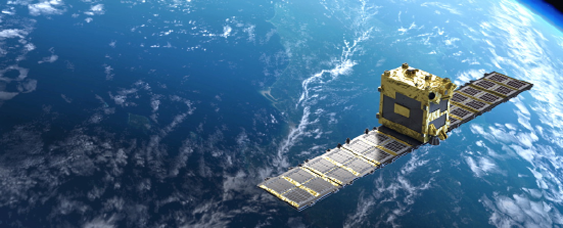
Artistic rendition of Synspective’s StriX satellite that is able to target data with a ground resolution of 1-3 meters, single polarized (VV), and a swath width of more than 10-30 km. Image is courtesy of the company.
For all industries, it is important that the satellite data is available on a global scale, and is easily accessible and understood. Government agencies and academic institutions have the capability to analyze SAR images, but most commercial companies do not. The key issue here is to provide SAR imagery as understandable information after acquisition.
To gather the most insight, it is necessary to combine SAR data with other forms of information. This can be obtained by combining SAR data with other data gathering methods, such as other satellites or Internet of Things (IoT) devices and systems. Currently, not many SAR satellites are deployed in orbit due to their high technological capability requirements. The increase in the number and capability of SAR satellites will increase the amount of knowledge available to the industry.
We recently have again seen the impact of natural disasters following the volcanic eruption in Tonga. How can data from SAR satellites make a positive difference in the aftermath of this type of event?
Akifumi Sumiya
When eruptive activities occur, optical images, such as those gathered by satellite, aircraft or drone, cannot be obtained due to cloudy weather. Instead, it is useful to monitor eruptive activities using SAR satellite data, especially in the case of eruptive activity far out in the ocean. Satellite data is the best option to monitor such events. Unlike traditional observation methods using optical satellites, aircraft or drones, SAR satellites are capable of all-weather ground observations, making it possible to quickly capture ground movements over a wide area in any environment.
Sustainability is a huge focus across industries, including space. Is there a role SAR satellites can play towards a more sustainable future?
Akifumi Sumiya
Having advanced sensors in orbit is very important for achieving sustainable development. A crucial problem of current market mechanisms is the inability to fully take into account how environmental changes affect various economic and social systems.
SAR data can serve as a tool to tackle climate change, to make cities more sustainable and resilient, protect industrialization and infrastructure, and even help response agencies save lives in risk-prone areas.
To achieve these goals, it is important that SAR data is used alongside other technologies, such as IoT and Artificial Intelligence (AI). By using data science and machine learning (ML) to engage in automated data analysis immediately, solutions in the form of easy-to-use and easy-to-understand information can be provided and used effectively.
synspective.com