
Will Thornton, Product Marketing Manager, Spirent Communications
Mankind’s first landing on the Moon is one of the most enduring images of human history, accompanied by a turn of phrase that is still repeated almost 60 years later. Perhaps surprisingly to sci-fi fans, since the last lunar landing in 1972, no human has been beyond Low Earth Orbit (LEO). However, with lunar operations from major space agencies planned, that’s about to change.
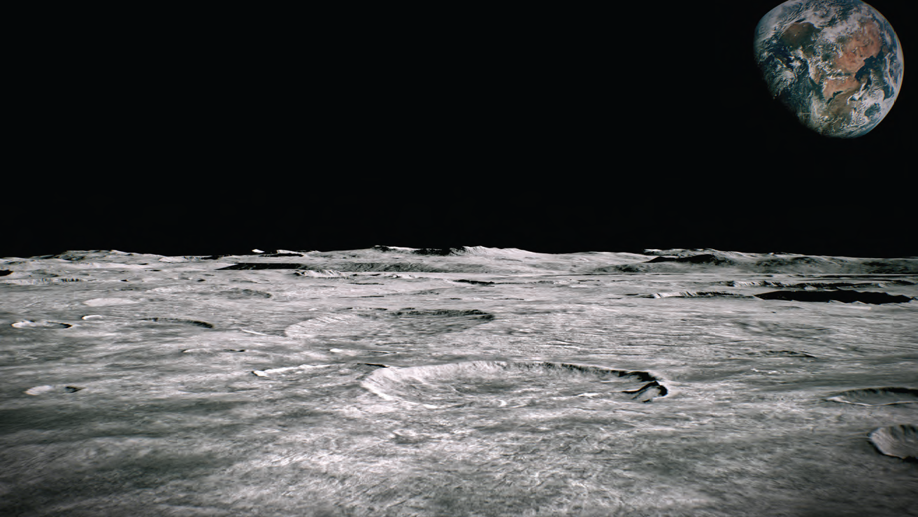
Unlike past missions, current and future lunar operations are aiming to create a sustainable presence on and around the Moon. But, despite its relative proximity to Earth, and despite having been there before, going to the Moon and establishing an enduring presence there comes with a significant set of challenges.
One of the foundational enablers for both lunar missions and lunar presence is positioning, navigation & timing (PNT). On Earth, PNT is referred to as the invisible utility. Global navigation satellite systems (GNSS) help us to position and to navigate and they also play a key role in applications as diverse as communications networks, energy grids, financial transactions, and more.
Without GNSS—or without an equivalent source of PNT data—mobility, autonomy, and coordination on and around the Moon are all but impossible. A key challenge to overcome, then, is how we derive and assure the availability of PNT data.
____________________________________
Using GNSS for Lunar Missions
____________________________________
When it comes to selecting a source of PNT data, GNSS is the gold standard. Availability, consistency, accuracy, and coverage all lend to its being the primary choice for most applications.
When considering lunar applications, though, there are some significant challenges to consider. In addition to the obvious fact that GNSS satellites are broadcasting their signals toward Earth, there is the decrease in power levels as one gets further away from the satellites, the need to reacquire satellites regularly at those lower power levels, and inherent issues with the geometry of GNSS.
Having said that, the LuGRE project has recently demonstrated the successful use of GNSS signals on the lunar surface. Using satellites orbiting the far side of Earth, the receiver was able to extract GNSS signals at extremely low power levels and output a positioning solution. This, then, means that GNSS can be used on the Moon—but it’s not a long-term solution. Precision is lower than on Earth, and half of the surface of the Moon is entirely obscured at any given time.
__________________________________________
A Dedicated Lunar Navigation System
__________________________________________
In parallel to explorations into the use of GNSS, plans are evolving for the cooperative development of a Lunar Navigation System (LNS). Led by the European Space Agency (ESA), Japanese Aerospace Exploration Agency (JAXA), and NASA, this LNS will take the form of a constellation of satellites orbiting the Moon. All parties are working towards the agreed LunaNet framework, which will see an initial constellation orbiting the lunar south pole broadcasting navigation signals in the S-band.
The opportunities opened up by a LNS are huge—in terms of precision, reliability, autonomy, redundancy, and more. But building this system comes with its own set of challenges, and simulation is at the forefront of this.
All design and testing takes place hundreds of thousands of miles away from the operating environment in conditions entirely alien to what the satellites will encounter in their operational lifetime. This means pushing our test environments as close as possible to a digital twin—enabling the design and test of the system, as well as of the downstream applications that will use its signals.
We must consider that the forces impacting orbits—atmospheric drag, gravity from various celestial bodies – are entirely different around the Moon; signal propagation is not impacted by ionospheric delay as it is on Earth; and much more.
____________________________
Fundamental Questions
____________________________
There are a series of fundamental questions that must be answered to establish an effective and consistent model for navigating to and around the Moon. Some of these must be answered before simulation models are finalized; others before the missions hit full swing.
First, how do we define a position on the Moon? GNSS (as well as all our other PNT systems) use Earth-centric reference systems. For instance, GPS uses WGS 84, meaning the coordinate origin is the center of Earth’s mass.
Using the center of Earth as the reference point for positioning on the Moon doesn’t make much sense, so the LNS will need to define a Moon-centric system. Then we have to ask: in lunar transfer, at what point do we switch reference systems? We’d need to be sure that we can use GNSS up to the point where we switch, and we’d need to be sure that we could use the LNS from the same point.
Second, how do we define time on the Moon? Precise timing is central to so many modern applications. We know that a second is exactly 9,192,631,770 vibrations of a cesium-133 atom, but we also know that time passes more quickly on the Moon. Should we relay time from Earth? Synchronize an independent timing source? Or use a separate timing standard?
The answers to these questions—and many others similar to these—might be arbitrary, but they must be agreed upon and they must be tested.
___________________________________________
Why Are We Going Back To The Moon?
___________________________________________
The more people you speak to about the planned lunar missions, the more you hear people ask: “Why?

There are a number of reasons why our governments and space agencies (and even private enterprises) are planning manned lunar missions. Establishing a permanent human presence on another celestial body is an established goal. Taking advantage of the available resources on another celestial body has significant potential.
With regards to navigation, the most interesting goal is to be able to use the Moon as a stopping-off point in further exploration of the solar system—or even the galaxy. With this lofty ambition in mind, it may be that we also need to consider what infrastructure might be required to aid in this exploration.
______________________________
We Are Already Underway
______________________________
These lunar plans are already turning into action. As mentioned earlier, LuGRE has already sent a GNSS receiver into lunar orbit and demonstrated it working. Planning and testing of the LNS is maturing—JAXA recently announced its purchase of a Spirent simulation system in order to model and create this new navigation system, and to test the devices that will use it.

Will Thornton We are going back to the Moon, and we are doing it in a spirit of cooperation rather than competition, and PNT is a cornerstone piece of this mission.
www.spirent.com
Author Will Thornton is the Product Marketing Manager for Spirent