
Mr. Joerg F. Herrmann is Senior Vice President of Special Projects at Capella Space Corp. He previously served as senior business development executive at Airbus Defence and Space.
`He initiated the commercialization of Synthetic-aperture radar (SAR) satellite remote sensing in Germany through the TerraSAR program and served as founding CEO of the TerraSAR-X services entity, Infoterra.
During his more than 30 years in geospatial and space industry he worked in system engineering and design, program management, marketing and sales, strategy and business development, and general management.
In recent years, he developed strategic partnerships and conducted fund raising for innovative space initiatives involving SAR satellite constellations, and laser communication.
His educational background is in engineering, business administration, and entrepreneurship.
Mr. Herrmann, what barriers did you face in commercializing Earth Observation (EO) data early in
your career?
your career?
Joerg F. Herrmann (JFH)
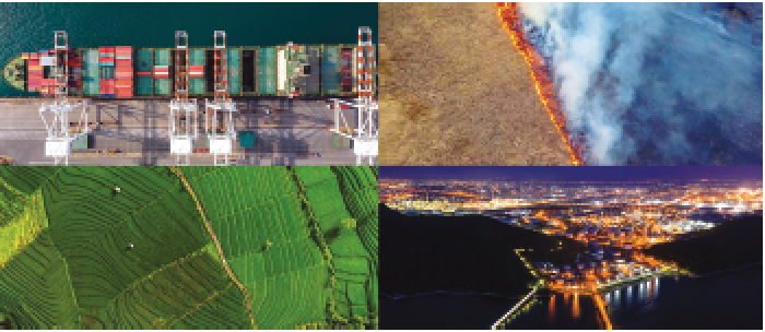
I’ve worked in the space industry since the end of the 1980s and my dream has always been to democratize radar satellite imagery, known as Synthetic Aperture Radar (SAR), for broad commercial use. SAR data holds tremendous value for commercial markets because unlike traditional optical satellites, SAR satellites can see at night and through clouds, and measure very precisely elevation and changes on the Earth’s surface. However, back then there were three main barriers that made this dream of commercializing SAR data difficult to achieve.
The first was a lack of market maturity. People were simply not aware of what very high resolution (VHR) SAR data was or how it could be used. The market had just become familiar with optical imagery, which was much easier to sell since it was pleasant to look at and intuitive to understand, but understanding a radar image is more complex and requires physical knowledge.
Secondly, there was a lack of experts in SAR data. The industry needed application developers who could understand how to use SAR data, but only very few universities had the resources to teach these skills. My team actively traveled around Central Europe to find people that would teach the matter and have students at universities to work on SAR applications. Over time, we built relationships with these professors and their students, and we supervised more than 50 thesis papers on SAR.
Lastly, as we were developing new use cases for SAR technology applied in space, there were regulatory and compliance issues to be navigated. Since SAR had previously only been used by the government, we had to figure out how to overcome the regulatory hurdles to commercialize VHR space-based SAR in general.
How has SAR evolved over your career — and how has it surprised you?
JFH
 Artistic rendition of Capella smallsats on-orbit. Image is courtesy of the company.
When I started my career, SAR data was mainly used for science and research projects. First applications came in the 1990s with maritime surveillance, and in the early 2000s the Shuttle Radar Topography Mission was started as an international effort that obtained a digital elevation model on a near-global scale to generate the then most complete high-resolution digital topographic database of Earth.
VHR SAR was only available from aircraft at significant cost. Now, SAR is being commercialized so that organizations—from government to businesses—can reap its benefits to provide real-time insights about the changes happening on Earth.
I’m surprised that the price of SAR data is still a barrier in using it. When SAR was first introduced, optical imagery was comparable in cost, but as the market matured the cost for optical decreased and the cost for SAR data has remained at a fairly high level. This is one of the breakthroughs Capella hopes to make to allow organizations to get just the SAR data they need, when it’s needed.
You have an impressive career working with some of the biggest names in the industry. What attracted you to leave Airbus and come to Capella?
JFH
Working at one of the world’s largest aerospace and defence companies taught me a lot about building space systems and working with the government, but I knew I needed to be at a company that could move quickly and be agile to make my career-long dream of commercializing SAR come true.
Silicon Valley is unique in that there is a great enthusiasm to apply new and unconventional technological approaches to something that is already on the market to develop a new solution.
This creative approach mixed with venture capitalism makes for a great environment to build the future of commercial space.
When I met Capella Space CEO Payam Banazadeh a couple years ago, it was clear he was building something really powerful and that we share the same mission of disrupting how SAR is being used. I saw for the first time a tangible path to achieving what I always believed would be possible with SAR technology.
There are a handful of other small satellite constellations being built. What is unique about Capella Space?
JFH
Once Capella’s constellation of satellites is built and deployed, we will offer the most frequent, timely and flexible very high-resolution SAR data for detecting and monitoring change on our planet.
Across the industry, there are barriers making this type of data inaccessible, unusable or unaffordable. We’re transforming the industry to meet the market demand for timely and reliable SAR data.
We are building a symmetrical, 12-plane constellation comprised of 36 radar satellites that will allow Capella to get data of any point on Earth every hour — an industry first.
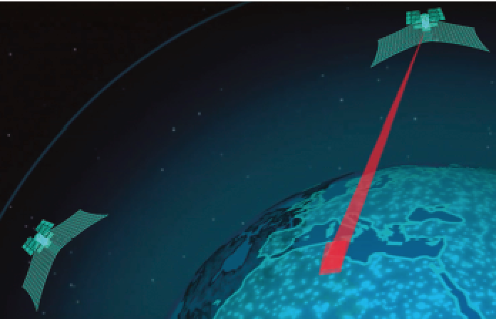
We recently entered a deal with leading satellite communications company Inmarsat and broadband communications technology provider Addvalue that will give us a significant market lead as the only SAR provider with real-time tasking capability.
By having constant contact via Inmarsat’s network of communications satellites to our fleet, we’re able to drastically reduce the time it takes to order and deliver very high-resolution Earth imagery from hours to minutes.
 Task, Acquire... Deliver.
Earlier this year, we also announced a partnership with Amazon Web Services (AWS) to establish a ground infrastructure that will allow us to directly downlink data and deliver it to customers through the Amazon cloud.
This partnership will help Capella customers receive image products requested just minutes after it’s acquired, rather than having to wait for the satellite to fly over an area with a ground station in the customer vicinity.
Capella is also modernizing the process of ordering and delivering satellite imagery. Traditionally, satellite imagery would have to be ordered through outdated systems such as fax machines.
Capella customers will use a web application to instantly log and verify satellite tasking requests, that will then be forwarded through the network to the next available satellite.
The satellite will maneuver to complete the task and return the image and data to the ground station network within minutes of it being captured.
The infrastructure we’re building will give us a significant market lead as the only SAR provider offering on-demand Earth imagery.
Additionally, as the only U.S. commercial SAR provider, we have a leg up in working with the U.S. government and have built our services to be complementary with the Earth observation information already used by the government.
Capella recently launched a developer community. How do you think this will help with the widespread adoption and development of SAR data?
JFH
SAR data has many practical applications, but organizations haven’t had the chance to realize these solutions.
We recently launched the Capella User Community, as well as a partnership with SpaceNet, a nonprofit focused on geospatial applications for artificial intelligence, to broaden the adoption of SAR.
Members of the Capella User Community will have free access to its data to explore different applications to solve some of our world’s greatest problems—from natural disaster response and city planning to illegal fishing monitoring in exchange for feedback and results of their projects.
We invite academics, non-government organizations (NGOs), governments and companies to join and explore new applications for SAR data.
Where do you think this technology will be in 10 years and how will it
be used?
be used?
JFH
In 10 years, I believe affordable information services from SAR technology will be widely available for commercial use, and integrating other technology like machine learning will also play a large role in creating actionable insights from SAR data.
Our huge data capability and collection with computer power and smart algorithms will train artificial intelligence faster than ever before.
Machine learning will be fed so much SAR data that it will be able to quickly identify changes and characterize patterns of life at a local level, which will remove the barrier of needing an expert who can read and interpret SAR images.