
Mr. Lyons is currently a Partner with the Ratio Academy, a developer of online and corporate entrepreneurship and tech company management programs delivered worldwide.

He also serves both as Chairman of CypherPath, a converged infrastructure virtualization company and as a Director of Real-Time Innovations (www.rti.com), a focus on advanced real-time integration of complex systems and a major thought leader in the Industrial Internet of Things (IIoT).
He is a strategic advisor to ICEYE, a SAR-based microsatellite data acquisition company and CEO of the company’s U.S. data subsidiary driving machine learning for SAR data. He has co-founded more than nine companies including SafeView, Inc., in 2002, a Government Laboratory spinout, to address aspects of the anti-terrorist physical security market, that sold to L3 Communications and is now the security standard in airports worldwide.

He is also a Managing Director of NewLine Ventures, a management consulting firm, www.newlineventures.com. He has also served as a Venture Partner with the Paladin Capital Group in Washington, D.C. and for ePlanet Ventures I and II. He was a co-founder and General Partner of Zilkha Venture Partners based in Silicon Valley and New York.
Concurrently, Mr. Lyons is an Adjunct Professor at the Stanford University Departments of Management Science and Engineering and Civil and Environmental Engineering. Serving in the Stanford position since 1988, he was a co-developer of the Stanford Technology Ventures Program and the founding professor of Technology Venture Formation. He has co-produced and delivered numerous other SCPD and STVP Executive Education programs.
What are the key goals for ICEYE US for 2018?
Mike Lyons (ML)
There are a number of goals that we’re hoping to achieve throughout 2018. For ICEYE US, we’re very focused on further developing new technology capabilities and acquiring customers for several different services including our data delivery platform, and data analytics services.
The first part of this goal is to continue closing development contracts for ICEYE’s Earth observation data with U.S. customers. Second, ICEYE US is working on identifying objects of interest for these customers and using machine learning to begin automating these processes.
The ICEYE-X1 SAR satellite was launched in January and has been reported as a success. What’s the status of the ICEYE-X1 mission?
ML
As ICEYE-X1 has been a proof-of-concept mission, ICEYE’s goals were set as demonstrating our own small satellite bus structure, our SAR technology, systems integration, processes and image processing. All of these targets have been passed with flying colors.
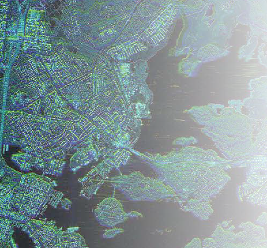
SAR image example — Helsinki, Norway. Image is courtesy of ICEYE.
There have been more than 400 images taken with ICEYE-X1, which has given us both drive and knowledge on how to push towards ICEYE-X2 and ICEYE-X3. The satellites following ICEYE-X1 are going to be at 3x3 meter resolution, an increase from 10x10 meters for ICEYE-X1.
What should the satellite industry expect from your next mission, ICEYE-X2?
ML
ICEYE-X2 will be providing much better image resolution than that of ICEYE-X1, pushing the industry standards of what is possible with such a small SAR spacecraft. As a detail among many, because of the increased image resolution, we anticipate there will be even more government customer interest, which we’re looking forward to accommodating.
ICEYE has mentioned before to be taking a risk-mitigation approach to launches — what is the impact of that decision?
ML
Spreading risk across different launch providers is a sensible strategy for any satellite manufacturer, including ICEYE. As it stands, there aren’t many launch choices available, but I believe we’ll see a large transformation in the industry over the next few years given the direction the industry is moving. With the advent of companies such as Vector, launch vehicle availability will start to increase for small satellites like ICEYE’s.
Synthetic-aperture radar data has not been in as wide use as optical data, what is behind ICEYE’s focus on that?
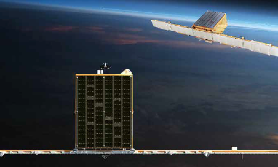
Artistic rendition of the ICEYE-X1 SAR satellite. Image is courtesy of ICEYE.
ML
The key value-add that synthetic-aperture radar (SAR) provides the industry has always been the ability to provide imagery regardless of clouds, weather or darkness. Optical systems are hindered from imaging the world about two-thirds of the time since this technology is restricted by weather and light; without sunlight illumination, optical systems do not provide what you need.
To get around these restrictions, companies must turn to radar technology, which is the attractiveness of SAR sensors. Being able to see regardless of time of day or weather is a substantial improvement on what is out there, which is one of the reasons why ICEYE has focused on this. The company first started monitoring ice through SAR technology, specifically how ice impedes business, and since then, we have extended the uses to reach far beyond.
How is artificial intelligence and machine learning being applied to Earth observation data? What is ICEYE’s approach?
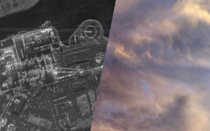
ICEYE-X1 satellite’s SAR cloud penetration for image capture.
ML
As more and more data becomes available, the applications of using machine learning to categorize and itemize specific objects with SAR becomes better and better. This in turn allows us to create trends and apply change detection for industries that before may have not have even considered using Earth observation data.
Today, there is simply not enough SAR data being generated, and machine learning is limited to enable this just yet, but over time it is inevitable due to the developments in the industry. The more satellites there are on orbit, the more data we will receive and thus, more use cases that can be created.
We’ve already started working on automatic ship detection and expect this capability to improve over time. Soon enough, we’ll be able to identify, track and discover specific targets on Earth automatically through the use of machine learning. While it’s a new area of technology for ICEYE, there’s already been a considerable amount of work on this, and we’re hoping to bring these capabilities to the commercial side in a timely manner.
We’ve only just wetted everyone’s appetite with the information that can be drawn from machine learning, and I’m excited to see our work at ICEYE come to fruition on that.
www.iceye.com/